Protected by its Breakwater, the Sound provides excellent shelter and a beautiful backdrop for recreational boating and sailing around Plymouth. It can be entered by either the Western or Eastern channels, which are both well buoyed and lit. Inside the Sound there are no real hazards and no shoals with less than 3.7m at MLWS, although care is needed to the west of Drake’s Island.
Entering Plymouth by boat
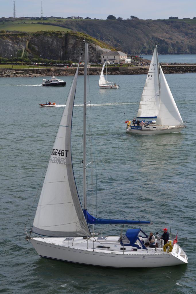
North of the Breakwater
Rule 9 of the International Regulations of Collisions at Sea is in force at all times, therefore:
● All vessels under 20m in length and all sailing vessels must give way to vessels over 20m long.
● All vessels are to keep at least 50m clear of all military vessels (100m for submarines) both alongside and at anchor.
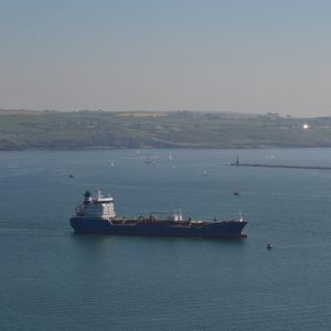
Stay safe! Keep clear of marked deep water channels, which are used by HM ships, channel ferries, tankers, bulk carriers and the fishing fleet. Wherever possible, channels should be crossed at right angles.
Craft heading for Mayflower Marina, King Point Marina, the Hamoaze and the River Tamar
Keep watch for ferries turning outside the entrance to Millbay Docks.
Look out for naval ships entering/leaving Devonport Naval Base, particularly in the Narrows where there are strong tidal streams.
The shortcut to the Hamoaze between Drake’s Island and Mount Edgcumbe (known as ‘The Bridge’) has 2.9m at MLWS.
Craft heading for Sutton Harbour, Queen Anne’s Battery and Plymouth Yacht Haven marinas
Look out for tankers and bulk carriers when sailing in or near the Cattewater.
Sutton Harbour Marina is entered through a traffic light controlled 44m x 12m lock, operated free of charge, 24hrs a day (Call VHF Channel 12). The lock operates in free flow mode for approx. 3 hours either side of high water.
Important Information about sailing in the MPA
Plymouth is a busy port, servicing commercial, naval, transport and recreational vessels and craft, with a large tidal range, up to 5.85m. It’s important to be aware of local navigational and tidal information when boating or sailing around Plymouth and the MPA.
Navigational safety
The deep water navigation channels are well marked by buoys and lights. The Plymouth Sound is a busy working port, and the channels are in constant use by the Royal Navy, ferries, large tankers, bulk carriers, fishing vessels and other traffic.
For your safety, recreational and small craft users should:
● Keep well clear of the channels, or if you have to cross them, do so at right angles as far as is practical.
● Obey Rule 9 of the Collision Regulations for conduct in narrow channels.
Navigation and the tide
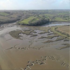
River Lynher – dries extensively but is navigable on the flood tide up to St Germans Quay (no mooring).
River Tamar – navigable on the flood tide to Calstock, 12 miles above the Tamar Bridges.
River Tavy – only accessible to unmasted craft and is navigable to Bere Ferrers.
Things to be aware of
● No mooring or landing is permitted on the Plymouth Breakwater.
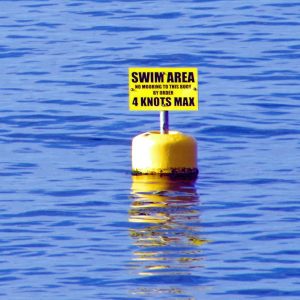
● Seasonal swimming areas off the Hoe foreshore, Bovisand Bay, Cawsand Bay and Western King are marked by yellow buoys.
● Beware of boats flying the blue & white ‘A’ flag – this indicates there are divers in the water.
● Small craft must avoid impeding the Torpoint Floating Bridge Chain Ferry that crosses between Devonport and Torpoint.
VHF Radio Channels
The recognised ship-to-ship channels are 6, 8, 72 and 77.
Remember!
Channel 16 is a distress, safety and calling channel only. Other than for distress, it must only be used to establish contact before going to a recognised channel. Port operation channels must not be used for ship-to-ship communications..
Port operation channels:
11 Tug Control
12 Sutton Lock working channel
14 VTS/QHM Naval & Commercial Port Control
14 Plymouth Pilots calling channel
65 Rame Head
63 or 73 HM Coastguard working channels
37 & 80 Marina working channels
BOATING AND THE MARINE ENVIRONMENT
Being responsible when sailing or boating is vital for our environment. It is often exciting and enticing to get a closer look at wildlife, but we must avoid causing disturbance. We must also make sure we take care of the marine environment and know what, and what not, to do. The Green Blue is a fantastic go-to for advice for boat users on the water.

Wildlife encounters
● Keep your distance: the Green Blue recommend you stay 100m away from marine creatures in the water and 50m away from marine creatures on the shore.
● Use your binoculars: if you wanted to take a close look at some on the wildlife in, on or by the water, use binoculars. If you don’t need to use binoculars to view the wildlife, you’re probably too close.
● Slow and steady: if you spot something over 100m away, keep a steady speed and stay on course, but be ready to slow down and react to the creature’s movements. If it’s less than 100m, slow down and be prepared to stop to avoid collision but stay safe and don’t put yourself in any unnecessary danger.
● Time to leave: if you spot marine creatures, let them take control – let them choose when to leave and do not follow them.
● Respect the wildlife: never turn your propellers towards the animals, get too close or chase them. Avoid separating groups of creatures and treat the animals with respect
Protecting the environment
● Oil & Fuel: oil and fuel pollution is devastating for marine life. Make sure you check for oil leaks, avoid spills and never pour any waste directly into the sea – dispose of it appropriately.
● Cleaning your boat: use environmentally friendly cleaning products and avoid toxic solutions.
● Anti-fouling: prevent anti-fouling from entering the water by catching it in tarpaulin and disposing of it safely, and choose the lowest biocide levels for your needs.
● Litter: never throw litter into the water, or even food and products you may believe to be biodegradable. Dispose of it appropriately when you return to land, recycling when possible.
● Invasive non-native species: avoid spreading invasive non-native species by following the Green Blue’s Check, Clean, Dry.
● Discharge Sewage: if you must discharge sewage, make sure you do it at least 3 miles from shore or use pump out facilities on-shore.
Visit the Protecting Our Marine Environment page for more information and advice.
The Green Blue
Helping you to go green on board
Developed by the Royal Yachting Association and British Marine, The Green Blue is an environmental programme that provides useful tips and guidance for boaters about how to go green on board. There’s information about the impacts of recreational boating on the marine environment, along with practical advice showing how you can help to protect our waters and marine wildlife to help safeguard our waters and marine wildlife for present and future generations. For more information you can contact The Green Blue at info@thegreenblue.org.uk, or visit their website.
The Queen’s Harbour Master
Safety, navigation and Local Notice to Mariners
For more information on navigation and safety when sailing and boating in the area, and for the Plymouth Local Notices to Mariners & Navigational Warnings, visit the Queen’s Harbour Master’s website.